Length: 8.5 km (5.3 miles), terrain flat
Munich Running Routes:
Best Munich Running Routes: Overview
Englischer Garten
Old town, English Garden, Isar
Nymphenburg Palace gardens
Olympiapark
Isar River south route
Classical Munich
Starnberger See lake-side route
Westpark
Hirschgarten route
For more running routes see the route list.
I ran when it was getting dark, so most of the pictures are from Google StreetView.
Here's a fairly simple-to-describe route. Just start in the heart of town and run to the river, then turn south to run upriver a few kilometers, then cross to the other side and run back.
NOTE: see the Destinations Tips page for tips about spending your free time in this great town!
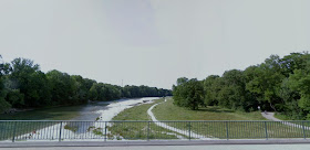
Munich is blessed with a long, park-lined, fast-moving mountain river, the Isar. There is a whole series of islands and piles of rounded river stones rising out of the whitewater the whole way through the city.
This route follows the somewhat less-used part of the river, heading south through the Ludwigsvorstadt neighborhood.
Let's start at the same place as the Munich Old Town Route, at the Marienplatz, in front of the gothic town hall.
 |
| Starting point at the town hall |
 |
| Isartor, from Google StreetView |
You will soon come to the next city gate, the Isartor, built when the city built a new wall further out from the town center. Continue straight past the Isartor on Zweibrückenstraße until you hit the river, at the Ludwigsbrücke.
 |
| Ludwigsbrücke: turn right here, from Google StreetView |
You'll see the Deutsches Museum complex directly across the river (really interesting technology museum, currently closed for refurbishment).
Turn right before the bridge to run down the sidewalk next to Erhardtstraße, with the river on your left. You will pass another five bridges before you reach the one you'll need. The street name changes to Wittelsbacherstraße.
 |
| Along Wittelsbacherstraße, from Google StreetView |
Just stay along the river for almost 2 km, until the main street swerves to the right, away from the river.
Wittelsbacherstraße stays along the riverside, here, becomming a quiet riverside sidestreet. Turn left to stay on Wittelsbacherstraße.
After a few blocks, you'll go under a railroad bridge (the last bridge before you cross the river). You'll then run straight into a riverside park, passing an electrical plant on the right side.
Continuing straight for a few hundred meters, you'll hit the busy cross-street, the Brudermühlstraße, also known as the Mittlerer Ring.
 |
| Turning onto Brudermühlstraße, from Google StreetView |
There are several paths running parallel to the river. The most interesting is the one that runs closest to the river.
 |
| View of the Isar-side path back to town, from Google StreetView |
Finally, you'll find yourself running past the Deutsches Museum again, sitting off to the left, on its island in the river.
 |
| Running by the Deutsches Museum, from Google StreetView |
No comments:
Post a Comment