Length 14.2 km (8.8 miles), terrain: a few short hills, gain 90 meters
Dublin Running Routes:
Georgian Heritage
River Liffey
Phoenix Park
Dun Laoghaire coastal run
City Centre loop
Howth Cliff Walk trail
See the other running routes here!
Phoenix Park is one of those places that every city needs: a big, green oasis full of gardens, sporting facilities and endless trails that wind their way through hill and glen. With playgrounds, flower gardens, a zoo, a fort, a castle tower, palaces, sports fields, ponds and monuments, it provides endless highlights and lookouts and spots to have fun. This is the place where Dublin goes to relax and play in nice weather.
 |
| Trail in Phoenix Park |
Phoenix park is diagonally bisected by a road, Chesterfield Avenue. The smaller, northern half of the park is filled with a lot of big things that are in the way of a good, free run: the Dublin Zoo, the Irish President's mansion, the visitor centre and its parking lots, and the polo grounds.
So it's better to head to the southern part of the park, where you can choose from a wide variety of dirt- and grassy trails and paved walkways.
 |
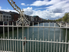
| Ha'penny Bridge, looking towards the run |
We'll follow the south shore on the way out, and the north on the way back. So turn west and head out along Wellington Quay along the south shore of the river. To avoid most pedestrians, stay on the sidewalk directly next to the water.
 |
| Along the Liffey |
A few blocks further west, you'll pass the James Joyce House, at 15 Usher's Island. Ireland honors its writers and poets like few other lands.
And two blocks further, you'll see Croppies Acre park and the National Museum of Ireland behind it, across the river (we'll run there later). The huge Guiness brewery is just to your left side.
At the brewery, we're almost at Heuston Station, so keep to the right and cross the river at the bridge, at the 2 kilometer mark.
 |
| Park entrance |
I said we'd stay along the south side of Chesterfield, but let's make a great exception right at the start: there is a little gate into the Peoples' Garden on the right side, let's head in there. It takes us away from the street and puts us right into one of the prettiest spots in the park.
Just run straight along the sidewalk into the garden, passing flower beds and fountains.
 |
| Peoples Garden |
After passing the tea rooms, at the 3-km mark, you'll come to the next cross-street, with the red ticket office for the Dublin Zoo on the far side.
The zoo will block our progress, so let's turn left and cross Chesterfield Avenue and continue southwest on the little street past the cricket fields. The street winds past a pond and then ends at an army sports club.
 |
| Where the sports fields begin: keep left and run towards the woods! |
Stay on the trail, which is parallel to and above a bigger, paved bike/running trail in the little valley to the left.
Eventually, your trail will merge into the paved one, after you get views of the Irish President's mansion way off to the right, Áras an Uachtaráin.
 |
| The Papal Cross |
We are now running through vast open fields called the "Fifteen Acres", with vistas in every direction. Off to the south you can see the faraway Wicklow Mountains.
 |
| The Fifteen Acres, with view of the mountains |
Follow the trails westwards and you'll come to a crossing of two small roads, Furze Road and Upper Glen Road. Cross the road on the left side and then head down into the valley to the left, along a dirt path.
 |
| Glen Pond |
Cross the road and continue southwards along the dirt trail that runs parallel with the street. Eventually, though, St. Mary's Hospital will block your way, at the 8-km mark, and you'll have to turn right to get back to Upper Glen Road again.
As the road heads downhill, take the first little road to the left, just below the hospital, and that connects into Military Road. This road has very little traffic, so follow it eastwards as it continues downhill, then winding around a few small valleys. We're running along the south edge of the big lawn where we were running westwards earlier.
 |
| The Magazine Fort |
Just past the fort, you must go down a steep hill, where you continue eastwards along Wellington Road, heading uphill again. When you reach the top of the hill you'll see a huge obelisk to the right. Cross the road and run past the monument, erected to memorialize the Duke of Wellington.
 |
| Wellington Monument |
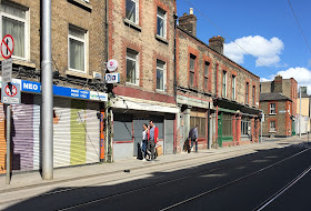
Head back towards Heuston Bridge, but instead of following the way we came before, keep to the left and follow Benburb Street to the left of the little triangular park, at the 12-km mark. Follow the tracks of the LUAS tram line, which runs here, parallel to the Liffey a block away on the right side.
A block later, you'll come to a bigger park, Croppies Acre, where Irish rebels ("croppies") from the 1798 Rebellion are buried. The park has been upgraded in the last years and you can now go into it and run parallel to the street.
The Irish National Museum is to the left, with art and design objects.
 |
| Along Benburb Street |
At Smithfields, you'll see one of those squares, at the Jameson Whiskey distillery, at the 13-km mark.
Later, when you cross Jervis Street with Wolftone Square, you'll run past the new Jervis shopping mall. Right at the mall entrance, you'll see a little pedestrian street turning south to your right, Millennium Walkway.
 |
| Along the Liffey boardwalk and the Ha'penny Bridge |
Now that was one long and scenic run!
I found this site while looking for running routes in Paris for an upcoming trip. Since I live in Dublin and run in Phoenix Park very frequently I thought I'd check this out. It's a very good route and you sound like a local! I probably wouldn't run along the Liffey with the traffic and forced stops for pedestrian crossings but if I were a tourist I think it would be interesting to see that part of the city at least once. Good job. I am very confident I'll enjoy some of your suggested routes in Paris. :)
ReplyDeleteThanks for the encouragement! I hope one of the suggested routes in Paris meets your fancy. Most streets in Paris are definitely NOT runner-friendly, but if you start looking for the parks, riverfront and backstreets, you'll find some great spots to explore!
Delete